
An 83-mile canal being carved through southern China is on track to reshape how goods move from the country’s interior to the rest of the world — and the scale of what’s being built explains why governments, shipping companies, and trade analysts across multiple continents are paying close attention.
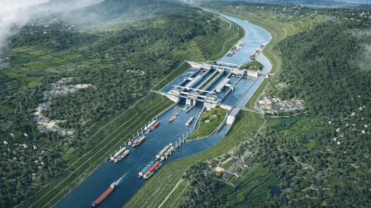
The project, known as the Pinglu Canal, runs from the Nanning area in China’s Guangxi region southward along the Qinjiang River toward the Beibu Gulf — also known internationally as the Gulf of Tonkin. When it opens, large cargo vessels will be able to travel directly from inland river networks to coastal ports and open ocean shipping lanes without the long detours that currently add both time and cost to every journey.
Officials have framed the completion date as late 2026, meaning this isn’t a distant proposal. It’s a project already deep into construction, and the world is watching to see what it means when the gates open.
What the Pinglu Canal Actually Is — and Why It’s Being Built
At its core, the Pinglu Canal solves a geography problem that has long frustrated logistics planners in southwestern China. Landlocked regions in the country’s interior have historically been forced to route freight on long overland journeys or through river systems that don’t connect efficiently to deep-water ports. That means higher transport costs, slower delivery times, and reduced competitiveness for goods produced far from the coast.
The new canal changes that equation directly. By linking inland river traffic to the Beibu Gulf, it creates a continuous water route from factory regions to international sea lanes — cutting what officials say could be hundreds of miles off current shipping paths.
Local authorities have positioned the canal as a central piece of what they call the “New International Land-Sea Trade Corridor,” a broader network designed to improve trade connectivity across the region. The Pinglu Canal isn’t a standalone infrastructure project — it’s meant to serve as a critical artery in a much larger system.
The Numbers Behind the Project
The raw facts about this canal make it easier to understand why it’s attracting so much attention. Here’s what
What This Could Mean for Trade — and for Prices
The impact of a project like this rarely stays contained to the region where it’s built. When shipping routes get shorter and cheaper, those savings tend to move through the supply chain in ways that eventually reach consumers.
Officials have noted that reduced transport costs could ripple from factories to ports and ultimately show up in the prices people pay on store shelves. That’s a broad claim, but it reflects a real dynamic: logistics costs are embedded in the price of almost everything that travels by sea.
- Shorter shipping routes mean lower fuel costs per journey
- Direct water connections reduce the need for expensive overland freight legs
- Faster transit times can improve inventory management for importers and exporters
- Improved access to coastal ports strengthens the competitiveness of goods from China’s southwestern interior
For countries that import Chinese-manufactured goods — which is most of the world — a meaningful reduction in transport costs on this corridor could quietly affect the price of products ranging from electronics to textiles to machinery components.
The Environmental Dimension Most Reports Gloss Over
Building an 83-mile artificial waterway capable of handling large cargo vessels is not a minor construction project. It involves significant earth movement, water diversion, and long-term changes to the local hydrology of the Qinjiang River corridor.
According to That framing is notable — it suggests awareness that projects of this scale carry ecological risk, and that the government is at least publicly committed to managing that risk alongside the construction.
Whether the environmental controls in practice match the ambition of that framing is a question that observers outside China — including regional governments bordering the Beibu Gulf — are likely to watch closely as the project moves toward completion.
What Happens When the Canal Opens
With a stated completion date of late 2026, the Pinglu Canal is not far off. Once operational, the immediate effect will be felt in the logistics networks of Guangxi and neighboring provinces, where shippers will have a new direct route to the sea that previously didn’t exist.
The broader effects — on trade volumes through the Beibu Gulf, on competing routes, and on the New International Land-Sea Trade Corridor as a whole — will take longer to measure. Infrastructure projects of this scale typically take years after opening before their full economic impact becomes clear.
What is already clear is that the canal has been built with large vessels in mind, designed for commercial-scale freight rather than smaller regional traffic. That signals China’s intention to use this route for serious international trade volume, not just domestic connectivity.
For anyone tracking global shipping, supply chains, or China’s infrastructure ambitions, late 2026 is a date worth marking.
Frequently Asked Questions
What is the Pinglu Canal?
The Pinglu Canal is an 83-mile shipping waterway under construction in China’s Guangxi region, designed to connect inland river networks to the Beibu Gulf and international sea lanes.
When is the Pinglu Canal expected to be completed?
Officials have stated the canal is slated to be finished in late 2026.
Where does the canal start and end?
It runs from the Nanning area in Guangxi, following the Qinjiang River south toward the Beibu Gulf, also known as the Gulf of Tonkin.
How will the canal affect shipping costs?
Officials say the canal could cut hundreds of miles off current shipping routes and lower transport costs, with potential downstream effects on consumer prices.
What is the New International Land-Sea Trade Corridor?
It is a broader trade network that Chinese authorities have identified as the strategic framework the Pinglu Canal is designed to serve as part of.
Are there environmental concerns about the project?


Leave a Reply