
The ground beneath Spain and Portugal feels as solid and permanent as anything on Earth. But according to a newly published scientific analysis, the Iberian Peninsula is actively moving — rotating, shifting, and responding to forces that have been building for millions of years. And the implications for how we understand earthquake risk across the region are significant.
Researchers have confirmed that the Iberian Peninsula sits on a crustal block that is rotating clockwise, driven by the ongoing collision between the African and Eurasian tectonic plates. The motion itself is tiny — imperceptible without precision instruments — but the forces it represents help explain one of the most puzzling features of seismic activity in Spain and Portugal: why earthquake hazard is spread across such a wide zone rather than concentrated along one clear fault line.
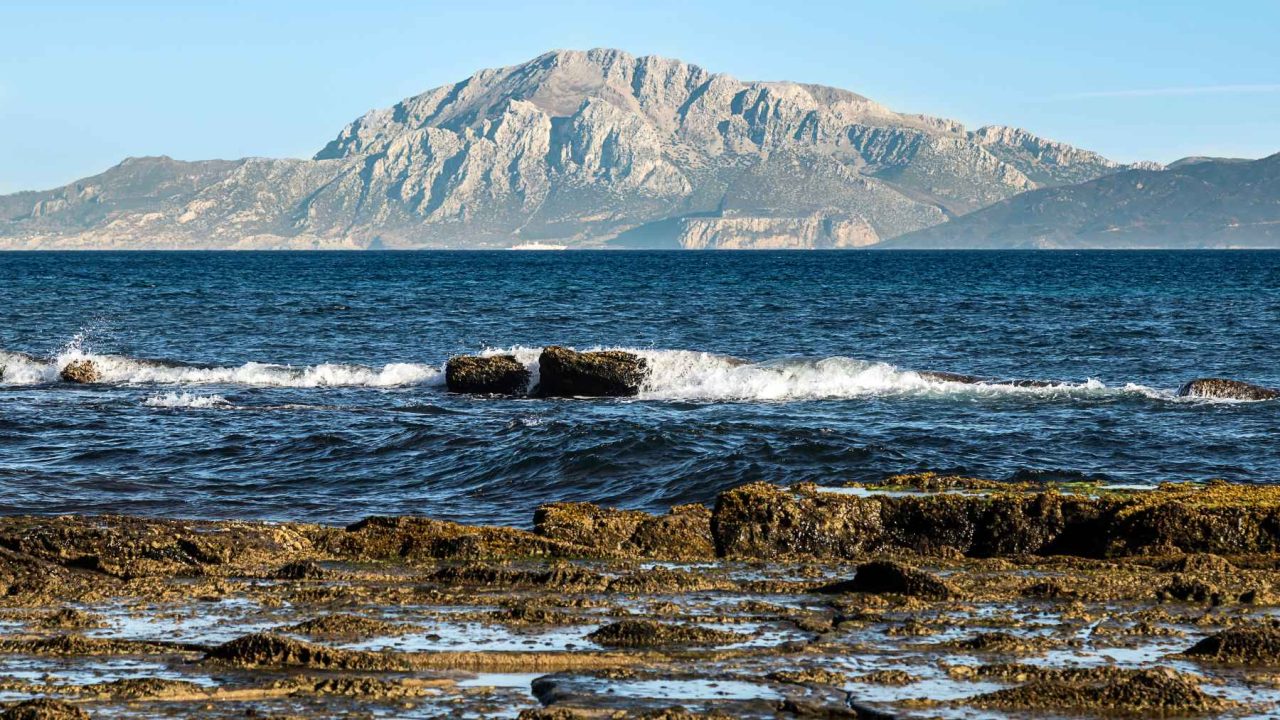
This isn’t a distant academic debate. The western Iberian margin has produced some of the most destructive earthquakes in European history, including the 1755 Lisbon earthquake that killed tens of thousands of people and sent a tsunami across the Atlantic. Understanding where stress is building in the crust today is directly connected to understanding where future earthquakes are most likely to occur.
What the New Research Actually Found
The study, published with the DOI reference doi.org/10.1016/j.gr.2025.08.020, was led by geologist Asier Madarieta-Txurruka, with coauthor Mimmo Palano. Open-access funding came from the University of the Basque Country, making the research freely available for other scientists to examine and build upon.
The team took an approach that combined two distinct types of data that are often studied separately. The first is seismology — the record of earthquakes and the stress patterns they reveal inside the crust. The second is geodesy — the precise measurement of how the Earth’s surface actually moves over time, largely made possible in recent decades by satellite positioning systems.
By comparing stress (the forces pushing and pulling inside the crust) with strain (the way the crust actually deforms in response to those forces), the researchers were able to build a sharper picture of crustal behavior across the Atlantic and the western Mediterranean than previous studies had achieved.
Critically, they used a larger earthquake dataset than most prior mapping efforts. More data means fewer gaps, and fewer gaps mean a more reliable picture of where motion is being stored quietly underground — and where it is being released.
Why the Iberian Peninsula Moves the Way It Does
The underlying driver is the slow but relentless collision between the African plate and the Eurasian plate. Africa is pushing northward into Europe, and the Iberian Peninsula sits at the western edge of that collision zone. Rather than being a passive bystander, the research confirms that the Iberian crustal block is actively rotating clockwise in response to those forces.
This rotation helps explain why earthquake activity in the region doesn’t follow a simple pattern. In places like California or Japan, seismic hazard tends to concentrate along well-defined fault systems. In Iberia, the hazard is more diffuse — spread across a broad zone that spans the Atlantic margin, the Pyrenees, and portions of the western Mediterranean.
When stress and strain measurements align in the same area, scientists can identify zones where the crust is being actively deformed. When they don’t align, it may signal areas where stress is accumulating without yet producing visible surface movement — potentially the most hazardous zones of all.
Key Details From the Study at a Glance
- The Iberian Peninsula is part of a crustal block that is rotating clockwise
- The rotation is driven by Africa’s ongoing collision with Eurasia
- Researchers combined satellite geodesy data with a larger-than-usual earthquake dataset
- The study covers the Atlantic region and the western Mediterranean
- The analysis is open-access, funded by the University of the Basque Country
- Lead researcher: Asier Madarieta-Txurruka; coauthor: Mimmo Palano
| Research Element | Detail |
|---|---|
| Lead Author | Asier Madarieta-Txurruka |
| Coauthor | Mimmo Palano |
| Funding Institution | University of the Basque Country |
| Access Type | Open-access |
| DOI Reference | doi.org/10.1016/j.gr.2025.08.020 |
| Key Method | Combined seismology (stress) with satellite geodesy (strain) |
| Region Studied | Atlantic and western Mediterranean |
What This Means for People Living in Spain and Portugal
For residents of the Iberian Peninsula, the practical significance of this research lies in earthquake preparedness and risk modeling. The study doesn’t predict a specific earthquake is imminent — that remains beyond the reach of current science. What it does is refine the map of where seismic hazard actually exists.
If earthquake risk is more widely distributed than older models suggested, that has real consequences for building codes, emergency planning, and infrastructure decisions in cities and regions that might previously have been considered lower risk. A more accurate picture of crustal deformation is a better foundation for those kinds of decisions.
The open-access nature of the research also matters here. Because the data and methodology are freely available, other scientists, urban planners, and government agencies can use and verify the findings without barriers. That transparency strengthens the case for taking the results seriously.
Where the Science Goes From Here
This study represents a methodological step forward — pairing two datasets that are often analyzed in isolation — but it is unlikely to be the final word. Researchers generally build on findings like these with more localized studies, higher-resolution data, and longer observation periods as satellite positioning technology continues to improve.
The western Mediterranean and the Atlantic margin of Iberia remain active areas of geological research, partly because the tectonic setting is genuinely complex and partly because the human stakes are high. As GPS networks become denser and earthquake catalogs grow longer, the picture of how the Iberian crust is deforming will continue to sharpen.
For now, the confirmed clockwise rotation of the Iberian block adds an important piece to that puzzle — and shifts how scientists think about where the next chapter of the Peninsula’s geological story will be written.
Frequently Asked Questions
Is the Iberian Peninsula actually moving right now?
Yes. According to the research, Spain and Portugal sit on a crustal block that is rotating clockwise in response to Africa pushing toward Eurasia, though the movement is extremely slow and not felt by people.
Who conducted this research?
The study was led by geologist Asier Madarieta-Txurruka, with coauthor Mimmo Palano, and was funded by the University of the Basque Country as an open-access publication.
What made this study different from previous research?
The team combined satellite geodesy data with a larger earthquake dataset than most prior studies used, allowing for a more detailed and reliable map of crustal stress and strain across the region.
Does this mean a major earthquake is coming to Spain or Portugal?
The research does not predict a specific earthquake. It refines the understanding of where seismic hazard is distributed, which is different from forecasting a particular event.
Why is earthquake hazard in Iberia spread across a wide zone?
The clockwise rotation of the Iberian crustal block, driven by the Africa-Eurasia collision, helps explain why seismic activity is diffuse across the region rather than concentrated along a single obvious fault line.
Where can I read the full study?
The research is available open-access at doi.org/10.1016/j.gr.2025.08.020, meaning it can be read and downloaded freely without a subscription.

Leave a Reply